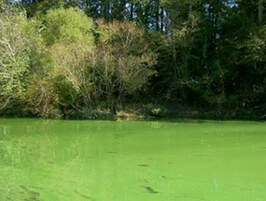
Aquatic systems and people in proximity to urbanization and intensified agriculture, will be at elevated risk due to increased storm frequency and intensity under climate change. North Carolina experienced 4 devastating '500-yr' hurricanes in 3 years, yet has also experienced more pronounced droughts in recent years associated with harmful algal blooms. The state's freshwater resources are impacted by numerous contaminants from both urban and agricultural sources. The Piedmont region has undergone rapid urban expansion in recent years, while agriculture continues to intensify. Notably, the state has among the highest densities of concentrated animal feeding operations (CAFOs) in the United States, mainly consisting of swine and poultry production. Nature-based strategies can play a role in improving resilience; for example, maintaining vegetated buffers can capture nutrients and increase water holding capacity, which improves water quality and protects downstream communities from flooding.
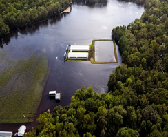
A swine waste lagoon and surrounding spray fields where liquid waste is applied near Kinston, NC flooded by Hurricane Florence. Photo: AP
|
|
|
During and after large storms it is difficult to monitor water quality -- many sensors go offline when flooded and hazardous conditions prevent manual sample collection.
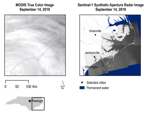
We used satellite-based radar to map hurricane-induced flooding from Hurricanes Matthew (2016) and Florence (2018). During large storm events, clouds can obscure our view of earth's surface in optical remote sensing imagery such as Landsat. Radar is particularly well suited for mapping flooding because it is effectively weather independent and is very sensitive to the presence and amount of water on the landscape. We examined at-risk contaminant sources, socioeconomically vulnerable communities and vulnerable freshwaters within hazard zones compared to remotely-sensed flooded regions. |
|
Matthew and Florence affected an area >23% larger than the ‘100-yr’ floodplain in NC. We identified disproportionate impacts on communities with senior citizens, people with disabilities, unemployed people, and people living in mobile homes not predicted by existing hazard maps. Although we know that flood risks and exposure are changing due to changes in the climate and continued development of floodplains, we continue to use the '100-yr' floodplain (1% annual chance of flooding) based on historical records for many key decisions. For example, flood insurance is required in the 100-yr floodplain and often limitations on new development and siting of contaminant sources also apply within this delineated area. |
|
|
|
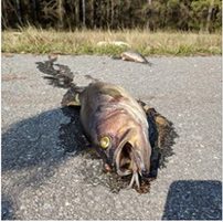
To illustrate the implications of using the legal floodplain for water quality under extreme events, we used the example of nutrient pollution. Nutrient pollution is one of the most widespread water quality issues in North Carolina, with both urban and agricultural sources contributing to the problem, which may be subject to different regulations. We detected potential flooding of numerous nutrient sources beyond the 100-yr floodplain due to Hurricanes Florence and Matthew, including: permitted wastewater treatment plants (point sources regulated under the National Pollution Discharge Elimination System [NPDES]), permitted swine CAFOs (point source and non-point source), and poultry CAFOs (not regulated by NPDES). Manure volume was estimated from the number of animals and standard production rates. |
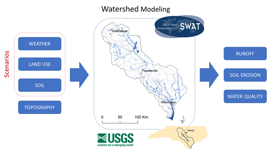
We identified extensive forests and wetlands that are still under threat from development. Marginal lands that have suffered repeated economic losses from flooding could also be restored to provide these natural benefits -- these are cost-effective wins that can help communities to be more resilient to future storms. To identify locations where interventions (e.g., restoration, modified agriculture management) should be located within the Cape Fear River Watershed with more specificity, we are using a hydrologic model to quantify water quality and flood retention benefits under scenarios ranging from hurricanes to droughts.
Our methods are transferable to studies in other flood prone regions, and findings have direct utility for policymakers and practitioners, who are seeking to better understand and mitigate water quality problems during extreme events.
This work is supported by a NatureNet Science Fellowship and a North Carolina Environmental Enhancement Grant.

|

|

|
